Sunday, July 27, 2008

Climate Change and the Bering Sea


Scientists studying the effects of climate change on the Bering Sea ecosystem.

Tuesday, September 11, 2007

Polar Perspectives at Liberty Science Center


Liberty Science Center has reopened, and the Polar Perspectives exhibition is up and running in the new Breakthroughs gallery. The overarching theme stems from the launch of the International Polar Year (2007-2009).

Polar Perspectives features this Bering Sea trip, along with a short video that highlights the research done aboard the Healy. There's an ice albedo activity that demonstrates how light surfaces reflect light while dark surfaces absorb light. This is a major issue as the ice starts to melt earlier and earlier in the Arctic regions.

Also featured are studies by ANDRILL, Columbia University's Lamont-Doherty Earth Observatoryand Woods Hole Oceanographic Institution (WHOI). In fact, we had a live chat via satellite phone with the WHOI scientists while they were in the Arctic Ocean studying the Gakkel Ridge.

If you live in the NY/NJ metro region, please visit Liberty Science Center and let us know what you think.

Friday, July 07, 2006

Listen to Karen on Scientific American's podcast

June 28, 2006 In this episode, science writer Karen de Seve shares her adventures in the Bering Sea; journalist Dr. John Miller talks about a radiation health conference; and taxonomist and paleontologist Scott Thomson discusses the late Harriet the tortoise. Plus we'll test your knowledge about some recent science in the news. Organizations and websites mentioned on this podcast include the Liberty Science Center, www.lsc.org; Karen de Seve's blog, http://beringsea.blogspot.com; the American Statistical Association, www.amstat.org; Wikipedia, http://en.wikipedia.org/wiki/Harriet; and the Scientific American Digital Archive, www.sciamdigital.com.

Saturday, June 10, 2006

Bering Sea Ice

Wednesday, June 07, 2006

Studying the Bering Sea from the Bottom Up

Residents in Nome and farther north in Alaska have witnessed climate change with their own eyes. Thinning ice sheets, fewer gray whales in the region and coastal villages sinking into the sea are telltale signs that the world is warming. But what about the communities of animals below the surface?

Scientists aboard the US Coast Guard Icebreaker Healy have just completed a month-long study of the Bering Sea. 
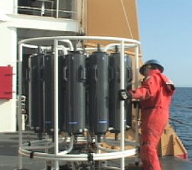
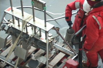
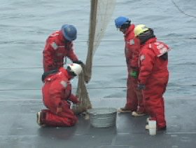
Their mission was to gather as much data as possible about the plants and animals in the water. “The main project was looking at what happens to the animals on the bottom as we see the ice recede in the springtime,” said Lee Cooper, one of the chief scientists leading the research cruise entitled, “Climate-driven Changes in Impacts of Benthic Predators in the Northern Bering Sea.” In this case, the benthic predators are walruses, sea ducks, gray whales, seals and crabs that feast on the food living on the seafloor. By monitoring these meals in the mud, researchers hope to better predict how climate change will affect the movement of predatory animals into and out of the Bering Sea. No one has previously investigated this aspect of climate change.

“One of things we’ve been seeing in the last few years is that the ice is leaving about three weeks earlier than before,” said Jackie Grebmeier, the other chief scientist aboard the Healy. “That has an impact because the animals are adapted to a certain timing.” The Bering Sea is one of the most, if not the most, productive oceans on Earth, but Grebmeier and the other scientists onboard have all said they see signs of the system slowing down.

Grebmeier, a researcher at the University of Tennessee, studies the flow of nutrients from the surface to the seafloor. Carbon, for example, is the main component of any diet. It starts at the surface in the form of algae. The algae bloom when the ice melts in the spring. If the timing is off due to an early ice melt, the plants and animals in the water must also adjust so they can get food. Grebmeier’s team is trying to see if who can adjust and who can’t.

Pieces of the Puzzle
Understanding changes in a whole ecosystem, such as the Bering Sea, involves investigating all the angles. Cooper and Grebmeier were joined by a small army of researchers from several universities. Each group was studying a different – but related -- piece of the climate change puzzle.

Beth Caissie and Kinuyo Kanamaru from the University of Massachusetts were collecting sediment samples to understand the climate as far back as 20,000 years. They sent down a device that took cylinder-shaped cores of the mud at the bottom.

Grebmeier also used the sediment samples. She set them in a dark, cold room that mimicked conditions on the seafloor and measured how quickly the tiny animals in the mud used up oxygen and gave off carbon dioxide to see how quickly they metabolize food.

Water samples collected at different depths were filtered through several different machines. Marjorie Brooks had one device that captured microscopic algae on thin paper discs. In the coming months, Brooks will analyze the algae in her lab at the University of Wyoming. She is looking for chemical “biomarkers” that she can trace all the way through the food web. “This will link the food web chemically,” said Brooks. “It will help us determine who is eating the algae and which animals are eaten by which predators.”

Brooks is working with Jim Lovvorn, also from the University of Wyoming. Lovvorn has been studying spectacled eiders for many years. These sea ducks dive to the bottom of the Bering Sea, some 50 to 80 meters down, to feed on the clams and other bivalves along the seafloor. But no one knows where these birds go just before they head for their springtime breeding sites farther north. “This is a critical time when females have to maintain and even gain weight before they arrive at breeding areas,” said Lovvorn. He took to the skies in on-board helicopter, but had no luck in locating the spectacled eiders. Their whereabouts remain a mystery.

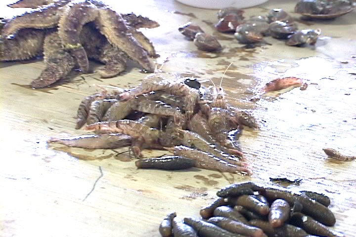
Less of a mystery, however, is the food available to the diving birds, walruses, whales and seals in the region. Lovvorn’s team did the first trawls in the Bering Sea to build a database of all of the species living at the bottom. Brooks will also trace her biomarkers through these samples to develop a food web model.

Of course, the food web has to begin somewhere. In this case, algae form the foundation for life in the Bering Sea. Karen Frey used the Healy’s satellite system to get snapshots of the sea ice from space. “I’m interested in the timing of when sea ice melts and when we get blooms of plants, or algae, in the water,” said Frey. “How long after the sea ice melts plants start to grow in the ocean?” Frey tracks when the sea ice melts, but she also follows the flow of algae down to the bottom by tracking the amount of chlorophyll (the chemical plants use to convert sunlight into energy) at different depths. “And when it falls to the bottom of the ocean, there are lots of critters down there that love to eat these algae species, so it is a very important time of the year for biological productivity,” she said.

Tying it All Together
So what does all of this research tell us about the Bering Sea? “I think the importance of the results we have found is that the biology and the physics are tied together,” said Grebmeier. “We’re seeing a decline of the prey source and the warming of the temperatures that will have large impacts that are beyond the one study area that we’ve been in.Those shifts are already pushing whale and walrus populations north. Subsistence hunters have felt this blow. Residents of Gambell failed to catch a whale this year.

The Healy research cruise, supported by the National Science Foundation, ended June 5, 2006, but Cooper said they plan to return next year to continue their work. “It is easy to show that the water has warmed up a few degrees and the ice has pulled back earlier,” he said. “But we’ve shown that under all that ice that things are changing on the bottom, too. The other point is that this is a very special system. As the climate changes, it is possible that the system we have now, with walrus and whales and seals that are associated with ice will be gone and we won’t have a special a place up here anymore.”

Saturday, June 03, 2006

For Bering Sea Ice, Timing is Everything

The engines roared as the Healy’s metal hull plowed into the thick white ice surrounding Big and Little Diomede islands. The ship collided with ice for several meters, swallowing ice chunks under the bow and then retreating to the open water it just created to get back to ramming speed. It seemed like we had made good headway through the ice pack. Yet, a satellite image revealed that the Healy had barely made a dent in the icy blanket around the islands. That made me wonder what else satellites are telling us about the Bering Sea.

“We can actually get real-time satellite imagery of where we are in the Bering Sea,” said Karen Frey, a scientist with the University of Tennessee. “The ship has an antenna mounted right above us, so it downloads data directly from the satellites orbiting the Earth.” Frey is using satellite imagery to track the sea ice in the Bering Sea. She is wants to know when the sea ice melts because that triggers a flurry of activity for the plants and animals in the water. If the melt happens too early, everything living in the Bering Sea has to adjust or move north to find more ice.

“I’m interested in the timing of when sea ice melts and when we get blooms of plants in the water. How long after the sea ice melts do plants start to grow in the ocean?” Frey explained. The plants she mentioned are not your regular garden variety, unless you are in the Bering Sea. “The general term for them is phytoplankton; it’s basically one-celled algae, like diatoms.” she explained.

To study the amount and location of this plant life in the water, Frey lowers a device that measures sunlight, temperature and chlorophyll to the seafloor some 30 to 50 meters below.

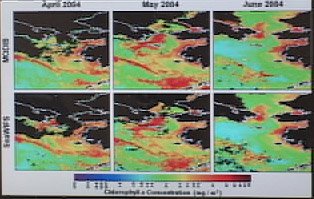
This time series image show chlorophyll in the Bering Sea during spring bloom in 1994. Black indicates no chlorophyll and red indicates lots of chlorophyll. The algae use chlorophyll to convert sunlight into energy during photosynthesis, so a lot of chlorophyll in the water indicates a lot of plant activity. “We’re really only seeing down to about 20 meters, so light’s not penetrating at certain wavelengths much deeper than that,” said Frey. “The phytoplankton in the ocean grow just like any other plant would; they need nutrients and sunlight. If light’s not penetrating deeper, then the phytoplankton aren’t able to photosynthesize at deeper depths because there’s no sunlight available at those depths. But we do see them at those depths. Basically that’s telling us that phytoplankton are forming at the surface and sinking down through of the water column.”

Sinking phytoplankton means a smorgasbord of seafood is on the way for the animals that live on the seafloor. Clams, sea cucumbers, shrimp-like amphipods and more gobble up the plants that drop to the bottom. In turn, walruses, seals and sea ducks dive to the seafloor to feast on those plant-eaters in the mud. Finally, local hunters from the islands rely on the walruses, seals and birds for food.

The trouble is, Frey and her colleagues aboard the Healy are seeing the springtime blooms earlier as the sea ice is starting to melt sooner than expected. “We’ve seen that spring is coming earlier and earlier every year. So not only are we seeing warming temperatures as a whole, but the timing of all of the things happening throughout the seasonal cycle is getting earlier,” she said. “That’s a problem for the animals that live here. We’ve seen northward movement of a lot of species.” The animals move north where the temperatures are colder, and the ice melts when they expect it to melt.” The image below shows a thick ice cover (red) north of the Bering Strait and a band of thin ice (blue) outlining the edges of Russia and Alaska. The large black portion in the lower left is open ocean.

“One of the reasons that Arctic stays cool is that we have all of these really bright reflective surfaces, really white colored surfaces like ice and snow,” explained Frey. “Once you start melting this ice and snow, you’re replacing really bright surfaces with very dark surfaces, like the ocean. The ocean is actually a very good absorber of sunlight. And when you’re a good absorber of sunlight, you actually warm the air temperatures even more.” Scientists call this trend the positive ice-albedo feedback loop. Once it starts, the whole systems “snowballs” into warmer and warmer temperatures.

“The Arctic specifically as a region is so much more susceptible to warming than anywhere else because of the ice-albedo feedback loops,” said Frey. Researchers say the five most extreme seasons have taken place in the last decade. “We’re seeing warming here more pronounced and earlier than anywhere else on Earth.” Researchers say in time, maybe not much time, we’ll see major changes taking place.


Thursday, June 01, 2006

Bering Sea: Back to the Future

If she had a time machine, Beth Caissie from the University of Massachusetts, Amherst, would probably transport herself back about 20,000 years ago to investigate ice in the Bering Sea at that time. Instead, she relies on the next best thing: sediment from the seafloor that holds an archive of life dating back 20,000 years. Understanding how the ice cover has changed over time will give researchers an inkling of what to expect in the future.

“I’m looking at diatoms, which are yellow-brown algae that like sea ice,” said Caissie. “ I’m comparing the species that live in the sea ice now and look down in time to see when those species were prevalent in the sediment.” Looking “down in time” means investigating the deeper layers of sediment. The deeper the layer, the older the mud. The older the mud, the older the diatoms. Unlike rock-based dirt on land, the sediment on the seafloor consists of
diatoms and other tiny plants made of silica, the same chemical in glass.

Caissie and other scientists aboard the Healy use a device called a Haps Corer to collect cylinder-shaped tubes of mud from the seafloor. They carefully prepare the tubes for travel back to the lab in Massachusetts for later testing. Each sample is painstakingly recorded, so scientists know where it came from and how long the sea ice covered that spot.

Caissie will prepare microscope slides of the mud so she can see the different species of diatoms that lived 20,000 years ago. “So I will look back in time to 20,000 years ago,” she said. “If I see a species that today lives in an area where there’s eight months of sea ice, it’s probably safe to say there was eight months of sea ice in that same spot 20,000 years ago.” Only time, and research, will tell how the sea ice will change in the future.

Wednesday, May 31, 2006

Q & A: Jackie Grebmeier

Jackie Grebmeier has a passion for mud-loving animals at the bottom of the Bering Sea. She's interested in how changes in the sea ice cover and the water temperature are affecting what lives down below. Jackie studies these benthic, or bottom-dwelling, creatures by grabbing scoops and cores of sediment that she (and her team) sift through to find out what lives on the seafloor. Jackie also places sediment samples in a room that's about -1 degree C (about 27 degrees F), which is the temperature at the bottom of the Bering Sea. She lets the mud "do its thing" for anywhere from 12 to 24 hours and then measures how quickly tiny animals in the sediment use up oxygen and give off carbon dioxide as an indicator of what's living on the seafloor. The following Q&A was adapted from an interview aboard the US Coast Guard Icebreaker Healy, May 27, 2006.


Dr. Jackie Grebmeier, Department of Ecology and Evolutionary Biology, University of Tennessee, with sediment cores. (Photo: Peter West, NSF)


KdS: What is your main area of research?


JG: My interest has always been in invertebrate zoology. I like the animals in the mud. But I like ecosystem studies, so I’m interested in what happens in the water column, namely how it is important to animals in the sediments and how carbon is cycled back into the water column.

KdS: So what brings you all the way to the Bering Sea?

JG: Well my interest here is to look at what is happening to the ecosystem. I started studying here because it is an area where local subsistence is very important to human communities on the islands. But on this trip, I’m looking at the temperature and salinity of the water and how it influences the animals on the bottom.

KdS: Why is the Bering Sea such an important feeding ground?

JG: The Bering Sea is a very wide shelf that’s only 30 to 40 meters deep. It’s one of the most productive regions in the Arctic. Since it’s shallow, things produced in the upper water column, like plant material, can get down to the sediment. That’s what I’m the most interested in.

KdS: Why is the mud on the seafloor so important?

JG: So, if you’re a plant and you need to grow, you have to have sunlight and so you stay near the surface. So the animals at the bottom are food limited and the only food that they’re getting, their carbon, is coming down from the top. So plants get down to the bottom and these animals, like marine worms or clams, suck up the carbon that settles to the bottom. Clams, for instance, have little siphons, and like a vacuum cleaner they suck up that carbon.

KdS: Where does all of this carbon come from?

JG: Carbon is food. We’re carbon based animals. When I talk about carbon, it’s organic carbon. So instead of saying the lettuce or the carrots are getting down to the bottom, it’s the phytoplankton, you know, the diatoms. If you look at them under the microscope, they are the beautiful circles. Diatoms are made out of silica, but inside is lots of chlorophyll (the chemical that lets plants convert sunlight into energy).

KdS: So the bottom-dwellers live on the carbon that settles on the seafloor. Who eats the bottom-dwellers?

JG: Well, diving birds called eiders dive down about 30 meters for shelled animals called bivalves. Gray whales breed and have their babies in Baja, California, and they travel 4,000 kilometers to feed here in the Bering Sea because the food is so rich. It’s richer than anything you’re going to find off the California coast for maintaining a large population. That’s why people like to eat walrus and bearded seal; they grow fat feeding here.

KdS: What about the people who don’t eat walrus and seal?

JG: Everybody knows the Bering Sea, whether they know the name or not, if they eat at McDonalds or eat fish sticks or fake crab meat that’s really pollack. The fish that we eat on a normal basis comes from the Bering Sea. So our large fisheries in the US come out of the southern Bering Sea, and that’s because it is so productive.

KdS: What sorts of ecosystem changes are you monitoring?

JG: We’ve been working over 22 years in the area. Basically there’s been about a 50 percent decrease in the amount of carbon being produced. We have seen a decline particularly in the last seven or eight years .There are fewer animals, they weigh less and the ice is extremely variable. We’ve been seeing that the ice is leaving about three weeks earlier than before, and that has an impact because animals here are adapted to a timing of when they are available to use the organic matter. For example, zooplankton have a resting stage. They only come out at certain times when the water gets a certain temperature. They need time to kick in and start chomping down on the carbon. That doesn’t happen when you suddenly change the system.

The last five years have seen the largest ice retreat, and 2005 was the highest on record. It was probably in the mid-90s that we started to see this warming trend. As the water warms up, it can push what’s called the sub-Arctic to Arctic boundary north. And so what that does is push these bottom communities that are the base for walrus and gray whales and bearded seals. So for example, when I was back here in the 80s doing my PhD work, the gray whales were feeding all around the basin we were just studying last week between St. Lawrence Island and Little Diomede in the Bering Strait. They are now moving north to Barrow, Alaska to find other feeding grounds because the ones down here are becoming less productive.

KdS: What are you looking for when you collect samples at each station?

JG: I need to know temperature and salinity, and I need to know how much organic matter is present in the water to get an idea if a lot of it is getting down to the bottom. So we look at chlorophyll for that, and I need to know what water mass the animals live in. So I’m interested in where that food is being produced, where it’s going and how it influences the communities on the bottom.

KdS: How do you study the sediment?

JG: For the benthic stuff, I use a van Veen grab (see May 25th "Sea of the Midnight Sun" post for details) to figure out what’s down there, and I sift out anything bigger than one millimeter. I collect those animals that are left, and I preserve them for study over the winter time at the university. So we determine who is in the neighborhood, what their names are, which species interact with each other and what they weigh.

But I’m also interested in how much carbon gets to the sediment. So I run experiments on chambers of undisturbed cores of sediment. We have a cold temperature room on board, which is minus 1.6 degrees C, something like 27 or 28 F, which is the temperature at the seafloor. That doesn’t freeze like an ice cube in your freezer because it’s got salt in it. So the more salt it has, the more you can drive the temperature down.

You just leave your experiments closed in the dark and basically you’ve got a little aquarium. So you let it do its thing in the dark, because it’s dark down on the bottom. After about 12 to 14 hours, you would see a decline over time of oxygen. So as the animals and the bacteria in the sediment consume oxygen, they give off carbon dioxide. So it’s that oxygen/CO2 cycling that is so important to the system up here. But instead of doing something on the bottom of the ocean, I’m bringing cores up on the ship.

KdS: Why should we care about this region?

JG: Well, I think we should care because the Arctic is the first indicator of a warming trend. When the ice melts here, it’s not raising sea level, but our glaciers are melting in Alaska and Patagonia and especially in Greenland. I think the big thing is that we’re interconnected. Whether you live in California or Gambell, AK, we are not alone anymore. What we do will impact citizens in all other parts of the world. That’s why other countries are interested in studying the Arctic. What happens with weather in the Arctic influences China and crop production in other places of the world.

Meet Ruth Cooper


I'm backtracking a bit since I had technical difficulties uploading posts from the Healy. The ship is wired in every capacity. Satellite tracking systems, intraship communications, radios galore and more scientific equipment than you could imagine. But for some reason the Internet connection at sea was not so good. Imagine that!

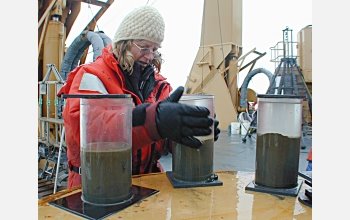
One of the most dynamic members of the science team was Ruth Cooper, the 11-year-old daughter of chief scientists Jackie Grebmeier and Lee Cooper. Ruth had just finished fifth grade, but she was experiencing the education of a lifetime aboard the Healy. Ruth helped with the stations (see May 25th "Sea of the Midnight Sun" post for details) and counted the brittle stars and other animals that came up in the nets. She also provided much entertainment around the ship.

When we were bouncing around in the little Zodiac launch next to the giant Healy, I asked Ruth if she wanted to become a scientist. She said, "No, I'm going to be a lawyer and then the first (or second) female President of the United States." Not a bad alternative career path.

Tuesday, May 30, 2006

Memorial Day in Gambell, AK

It is 1:15 AM in Gambell, Alaska, and the sun is just starting to set. This day has seen a flurry of activity, which is strange since I’m in such a remote part of the world. I knew I would ride the “helo,” or helicopter, from the Healy to Gambell today, but no one could say exactly when. The best estimates were early afternoon. We had been sailing through thick fog south of St. Lawrence Island for two days. This type of fog keeps airplanes and helicopters from flying. But the fog had lifted this morning, leaving behind whispers of high clouds against a pale blue sky.

After five days with the science team aboard the Healy, I’ve learned that plans can change in an instant. Today was no exception.
At 8:00 AM Jackie leaned over her homemade donut at breakfast to tell me that I was leaving at 9:00 AM. Her voice was quite calm, but her words were like a loud alarm clock that sent me into high gear. The next hour involved filming a final segment of Jackie with her experiments in the “cold room,” dashing up two decks to pack up my clothes and equipment in my cabin and then sprinting up three levels of icy metal stairs to the bridge for the preflight briefing with Captain Oliver and everyone involved in the helicopter flight. Phew!

Before I knew it, I was wearing a survival suit and helmet, airborne over the Bering Sea. Pilot Jim took us for a fun ride along the south-facing cliffs jutting out over the icy water. Then we headed north across St. Lawrence Island to
Gambell. This small village is on the western point of the island. About 35 miles of open water separates Gambell from Russia. The Yupik people here share a common language, Siberian Yupik, with their relatives in Russia. It was a little weird to be on land and seeing the Russian coastline in the same place each time I marveled at it. Aboard the moving Healy, I would see a different landscape each time I looked at the horizon.

The Gambell airport is a landing strip and a hanger. Residents come on their four-wheelers when flights arrive from Nome or Savoonga (on the other side of the island). These ATVs are the local taxis. There are no cars in Gambell. Except the landing strip, there is no pavement in Gambell. The “roads” are tracks in the deep gravel the covers the plateau at the base of a steep slope.


A nice older woman drove up to the helicopter as we were unloading our bags. She offered to help me and Annie Feidt get our gear to the lodge. We didn’t actually have rooms reserved, but somehow we knew we’d fine a place to sleep. The lodge was full of birders who had just flown in for a week of bird watching. Gambell is a prime birding destination, and avid birders are sure to see many exotic species on their seasonal routes.


Luck was with us. We ended up in the lodge’s annex, which is a smaller lodge that happened to be next to a small building housing two US Fish and Wildlife Service volunteers. They are collecting samples from birds shot by local hunters to see if avian flu. Both Annie and I were interested in talking to these ecologists, so our lives just got a little easier.

Mike and Lisa were home when we knocked. They are used to people just dropping by, but they were expecting a local person with news of a recent bird shooting. Mike and Lisa are ecologists from California who are “vacationing” in Gambell. Their job as USFWS volunteers is to meet the townspeople, find out what birds they are hunting and get fecal and feather samples from the felled birds. The samples will then go to Wisconsin lab for testing to see if any of the birds are carrying the H5N1 avian flu virus. Since this form of bird flu has been found throughout most of Asia, it is important to monitor wild birds that fly across the Bering Sea to the US. So far Mike and Lisa have collected about 85 samples, which they keep frozen in a liquid nitrogen container.

A Different Kind of Walrus Sighting
Later today day I hopped on the back of Lisa’s ATV and we zoomed across the pebbly soft terrain to look for interesting birds with local “birder” Jared. We visited the rocky slopes at one end of town. Then we drove across to the marsh. One little bird (I don’t remember the name) came quite close to us before flying away, pooping in mid-air. Lisa desperately searched through the brown grass to find what the bird left behind so she could sample it for testing.
No luck.

Around 11:00 PM we four-wheeled-it out to the end of the town to see auklets flock to the rocks high up the steep slope that forms a dramatic backdrop to the flat land below. It was still quite light out. For some reason these birds give off a sweet smell, almost like tangerine. Lisa marvels at the fact that she actually enjoys handling the dead auklets that hunters bring her because the birds smell so good. At the slope, Annie and I both climbed the little trail amid the rocks and lichens to get a better view and sound of the birds. In the distance, I could see the walrus hunting boats heading home for the night. Mike saw hunters shoot a walrus earlier with his spotting scope. We decided to drive down the beach to see what they caught. Along with sea birds, walruses provide much of food that the people of Gambell eat. Groceries are very expensive: a box of oatmeal packets is $8.00. Families in Gambell rely on the sea and sky for their meat. Whales are also an important food stock for the Gambell residents, but they didn't catch one this year. No one is sure, but the lack of a whale may be a result of climate change.


Dozens of metal fishing boats filled the rocky shore. There were still some snow drifts left near the water, so the boats could easily slide up on the beach. Interspersed between the boats were red splotches of walrus blood where the hunters had disemboweled the small beasts. These were just the young ones. When they kill a walrus cow, the hunters also take the calf because the young ones can't survive alone. The adults are too heavy to bring back whole, so the hunters take out the skull, tusks and meat at sea and leave the carcass on the ice for the sea birds. I stood next to a baby male walrus lying on its back in the snow. Really, it was the skin and meat. All of the other parts had been removed. A woman came over to tell us that every part of the animal would be eaten or used in some way. “That’s the heart,” she said, pointing to a dark red blob. “We eat that. And all that sinew stuff, we eat that, too. Just add a little salt, and it is very tasty.” Next to the entrails was a plastic baggie stuffed full of soft clam bodies. “Those clams are from the walrus’s stomach,” said the woman. “Those are really good. You just clean them off and eat them. Yummy.”

We waited until the hunters and their families piled onto their ATVs and headed to their little houses with their prized walruses. Then we drove back to our lodge on the outskirts of town. I decided to trudge across the deep gravel to the main lodge so I could try to upload this post. It was 12:30 AM, and the sun was just beginning to set. Two little girls sat in the gravel watching their puppies, Toto and Angel, chase each other. “What’s your name?” yelled one of the girls to me. That’s an invitation to have a conversation. So I walked over an chatted with them for a while. It was refreshing to see kids out playing without a schedule or supervision. Granted it was after Midnight, but the sun was still up...and so were the kids.

Walruses Go with the Floes

One of the most peculiar things about walruses is that they are always touching each other. They lie in gregarious groups on the ice. They do the same in captivity. Carleton Ray, a walrus researcher and former curator of the New York Aquarium, said if a young walrus was asleep in a corner and a keeper came in the enclosure, when the young walrus woke up it would maneuver itself and sit on the keeper. That’s a 200-pound lap dog! Carleton also said that it is sometimes hard to count walruses in the wild because they lie piled on top of each other. It was hard to tell how many were underneath or which flippers belonged to whom.

The Bering Sea is a prime feeding ground for walruses because it is a shallow, productive body of water with ice floes. Walruses need floating platforms so they can haul out of the water to rest after hours—and sometimes days—of continuous feeding on the seafloor. These dynamic divers can scarf down around six to nine clams a minute by sucking the soft bodies out of the shell. Walruses play important roles in the marine ecosystem. Like gardeners turning soil, walruses churn the seafloor as they troll for food, releasing nutrients that other animals consume into the water. (Walrus photo courtesy of Karen Frey.)


Like so many animals in the Bering Sea, walruses depend on sea ice for survival. If the ice melts too early, the walrus population, well, goes with the floes. The Healy encountered about 1500 walruses in the northern Bering Sea a few days ago. We’ve sailed past small groups since then. Carleton Ray and other researchers on this cruise are interested in where the walruses go when the sea ice disappears from the Bering Sea.


Friday, May 26, 2006

Ahoy Walrus!

Yesterday morning, we passed through ice floes in the northern Bering Sea. We were en route to the Bering Strait, which is the 58-mile-wide channel that separates Russia and the US. I happened to be heading to the bow to see the ice that the Healy was parting as we sailed north. Someone yelled, "Walrus!" There they were off the bow. There were a couple of small groups watching the 402-foot-long Healy approach. Some stayed on the ice as we passed. Others, who were closer to the boat, slipped silently into the icy water. They bobbed up and down in groups.

Walruses lie on top of each other when on ice. In the water, they seemed to want to stay as a group, so they were hitting heads a little. This may have been just because they were startled by the boat and wanting to "run away." Carleton Ray, the walrus researcher on the boat, said walruses are quite graceful swimmers, but they look clunky on land. He said he had seen a little over a thousand walruses grouped together on a large swath of ice farther north a few days ago.

Walrus photo courtesy of Jackie Grebmeier.

Tomorrow is Today is Tomorrow

May 25, Bering Strait

The International Dateline is strange. From a distance it makes perfect sense. It is an imaginary line that marks the end of one 24-hour period. So every time this line passes the Sun, another day has gone by. The dateline runs between the western US and the eastern edge of Russia. You can find it on a map, but the experience of standing practically on it is quite different.

Today the Healy headed toward the channell that runs between Little Diomede Island, on the US side of the Bering Strait and Big Diomede Island on the Russian side. 
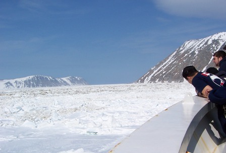
As the bow pointed down the International Dateline, most of the crew and scientists gathered on the bow to watch the Healy smash through the thick pack ice surrounding these two massive rocks jutting out of the Bering Sea. There was much discussion about what day it was on which island. It went something like, "Ok, so it's today over here on the right, but it is tomorrow just over there to the left? So it's basically now and 24 hours from now in the same spot? Wow. That's so weird."

The plan was to drop off Alaska Fish and Game researcher Gay Sheffield, who studies walruses and other marine mammals hunted by native communities. There is just such a tiny settlement teetering on one side of Little Diomede Island. It is literally the "village on the edge of tomorrow." Gay was going there to collect some samples from local hunters. These types of samples, along with tagging animals in the wild, help researchers track the movement of marine mammals and their genes. Knowing how genes are distributed throughout a population, especially a limited one such as walruses, helps keep tabs on the health of a whole species of animal.

We saw bunches of walruses earlier today. They are big, social marine mammals that tend to gather in groups on the ice floes. Most of the walruses in this region should be cows and calves out to feed in the Bering Sea. Males head to other locations this time of year. The ice provides a floating hunting platform for these long-toothed mammoths. Walrus researcher Carlton Ray is aboard the Healy to observe these groups in the Bering Sea. He said no one knows exactly why walruses cling together, lying on top of each other when there's room to spread out on the ice. They just like to do that.

The ship is shaking sporadically as I type because we are breaking through the pack ice around Little and Big Diomede Islands. Ice breaking in the Healy involves a long process of pushing forward, backing up and pushing forward again. The movement churns huge chunks of ice like a blender. Sea birds gather round the open water that's left behind, hoping to catch morsels of plankton let loose from the ice as it breaks under the Healy's hull. The sound is a tremendous bashing of metal against, well, ice. I'm heading up to the Bridge to see what's happening.

Thursday, May 25, 2006

Sea of the Midnight Sun

May 25th near Bering Strait

Anyone who ever waited for Santa Claus to arrive knows the excitement I’ve felt for the past 15 or so hours. We suited up in extra large dry suits and helmets for the helicopter flight from Nome to the Healy. Since this is a US Coast Guard ship, everyone working on deck or in a helicopter is required to wear certain safety equipment.

The flight took about an hour, and veteran pilot Jim pointed out wildlife along the way. From about 1500 feet aloft, however, they all resembled brown blobs. North of Nome, the landscape changed from rolling hills to flats that merged with pack ice jumbled against the coastline.
A few minutes later, the ice turned into floes and then disappeared completely as we neared the ship. Jim smoothly landed us on the flight deck and we hauled our gear to our cabins. It wasn’t long after a quick dinner that I jumped donned my videographer hat.

Lee and Jackie planned a series of eight “stations” for the next 14 hours or so. Giant cranes and winches raise and lower equipment from the aft deck (that’s at the stern). At each station, the science team deploys water collection tubes called CTDs, which collect water at different depths for various tests in the lab. Next is a zooplankton net. This is a fine scrim cone that captures little critters free-floating in the water. The science team sifts through piles of tiny marine organisms, documenting the number, type and condition of all of the different species.(Net photo courtesey of Karen Frey.)


The van Veen grab is the third piece of equipment to go off the stern. This is a smaller version of a steam shovel. The grab does what you might think. Technicians lower this scoop to the bottom and trigger it to close and grab whatever is there: mud, rocks and marine life. The scientists empty the contents into a big bin and collect small samples in tubes. Then the mother lode is run through a scrim, so the mud is washed away, but the rocks and lifeforms remain for counting.A trawl net also goes over the side, depending on the location of the station.
This net collects lots of little crabs, as well as clams and plenty of other little animals living near or on the seafloor.

In addition to Lee and Jackie’s team from the University of Tennessee, I’ve met scientists from the University of Wyoming, U Mass, Amherst and the University of Virginia. Work never stops on the Healy. It sails 24/7. Scientists are surveying and collecting around the clock. Each has a specialty: bird surveys, water chemistry, walrus observations, sediment history, etc. The data collected on this trip will be compared to data from previous and future trips to tell the story of how the Bering Sea ecology is changing over time (not much time, as it turns out).

Wednesday, May 24, 2006

Leaving Nome

May 24th 12:27 AM, Nome, AK

This morning I got a call from Jackie Grebmeier, one of the scientists on the Healy. The call was broken up, but I got the general idea that I should head to the airport to meet the helicopter that will fly me to the Healy. I think she said they were about 70 or 80 miles away.

I checked out of my room at the Aurora Inn and walked outside to wait for the taxi van to the airport. The morning sun (which looks a lot like the late afternoon 
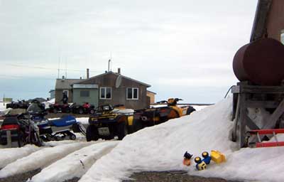
and late night sun, except from a different direction) was glistening off of the blanket of sea ice covering the Bering Sea, about 30 feet from the Aurora’s front door. The locals tell me this amount of sea ice is pretty normal for May. Last week it snowed in Nome. This week, the high temperature will be in the 50s. That’s also fairly normal for Nome around this time of year, although everyone is calling it a heat wave!

I rode to the airport with a woman and her young son who were heading home to Gambell, a small village on Saint Lawrence Island. It looked like they had been visiting family. They had boxes of blankets and other things, along with a tot-sized bicycle that had recently seen some good mud puddles. Everything travels by plane up here: cats and dogs, bikes, groceries, you name it. The woman said she was glad to be heading home; they had been waiting for the weather to clear for several days to be able to fly to Gambell.

At the airport, I met Annie Feidt, a producer for Alaskan Public Radio who is also heading to the Healy. Then Rebecca and Jim landed in the helicopter, kicking up copious amounts of dirt and foiling my attempt to film the landing. Live and learn. Rebecca is a graduate student studying under Lee Cooper and Jackie Grebmeier. She is shipping coolers of sediment samples back to their lab at the University of Tennessee. The analysis will look for levels of a chemical signpost for the amount of plankton that settles in the benthic, or bottom, soil.
I asked Rebecca about the ice out in the Bering Sea. She said there was pack ice earlier in the month, but it had all retreated north above the Bering Strait at this point. So, the Healy’s thick hull won’t be bashing through thick sheets when I’m aboard. There are some ice floes, but they are melting fast.

Rebecca also said the amount of ice retreat is quite disturbing. She’s been sailing with Lee and Jackie on these Arctic water cruises since 2001. She said she’s seen a change in the bottom-dwelling species they collect. Critters are migrating north as the nutrients in the sediment move north with the ice and cold waters. Most notably, the bivalves (namely clams) collected in 2006 are much smaller than those collected in 2001.

All of the researchers’ observations, plus analyses from sediment and water samples, are all pieces of the climate change puzzle. Each person specializes in a particular area: sea birds, water chemistry, sediment chemistry, ice distribution, etc. Woven together, these individual studies create a mosaic of research that tells the broader story about how climate change is affecting (in this case rearranging) the ecology of the Bering Sea. The broader implications are yet to be discovered, but scientists can see which way the road is heading.

Nomeward Bound

“You know you’re in the largest state in the union when…” Michele Shocked wasn't kidding when she sang those words. I was floored by the grand scale of the peaks, ridges and fjords of the Alaskan coastline, even from the plane. Then of course, it took hours to fly to Anchorage and then to Kotzubue and then to Nome. (In fact, it took 22 hrs. to travel from Newark, NJ to Nome, AK.)

Airplane, by the way, is the only way to reach some towns in Alaska. Kotzebue, a tiny northern settlement just inside the Arctic Circle, is one of those places. Weather dictates much of what happens in Alaska. Passengers on my flight from Anchorage to Kotzebue to Nome had been trying to get to Kotzebue for a couple of days, but high winds and fog often keep planes from taking off and landing there. So people can’t get in and out of Kotzebue, but neither can shipments of food and mail. When we left Anchorage at 6:30 PM, our flight was going to land in Nome and then attempt to travel north to Kotzebue. En route, the pilot announced that the weather had cleared and we’d be heading to Kotzebue first. This was great news for the 50 or so passengers hoping to make it to see this year’s high school graduation – a major social event for the families that live in Kotzebue.

We left Kotzebue around 8:30 PM. The sun was shining brightly. (In fact, the sun is just beginning to set now at Midnight.) There’s still a lot of sea ice surrounding Kotzebue and along the coast where Nome sits, a 35-minute flight southwest. I sat next to a woman who grew up in Nome. She said she’s noticed a change in the amount of ice near Nome each year. She’s especially noticed a change in the number of seals and walruses on the ice. When she was a kid in the 1970s and 80s, she used to see seals and walruses galore (her husband and her father are both bush pilots, so she gets to fly around a lot). This year she said she’s seen hardly any. Maybe I’ll find out some of the reasons why when I board the Healy tomorrow.

Monday, May 22, 2006

The algae that bloom in the spring...tra la

May 22nd: 11:00 PM EDT
I’m just a few hours away from heading to Nome, AK from Newark, NJ. It turns out that the Healy is closer to Nome than anticipated, so I may not have to fly to Gambell to meet the helicopter. I won’t know until I get to Nome, however. It makes for a dynamic start to my adventure.

The Healy’s last posted location was Lat 64.3714 Long -168.663. That means the ship 
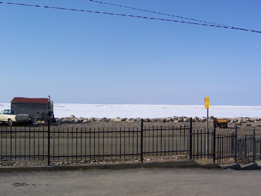
is north of St. Lawrence Island and well into the northern Bering Sea. Judging by the posted weather reports, the winds have settled down a bit. In early May, Healy faced 42-knot winds. You’d feel that wind hit your face at about 50 miles per hour. Today’s winds blew at a mere 8.6 knots.

The weather in Nome is predicted to be warm in the next few days. The highs will be in around 50 degrees F. I’m wondering if that’s unseasonably warm for Nome. Maybe the warm temperatures are affecting the sea ice, making it melt sooner than expected. The timing of the sea ice melt affects the whole food chain, from fish to large marine mammals. Melting releases a bloom of algae frozen in the sea ice during the winter. Crabs and sea cucumbers, among other bottom dwellers, feed on the algae. Fish and diving birds and seals eat the critters on the bottom. So an algal bloom that’s too soon will cause those animals higher on the food chain to head north—where ice will melt later in the spring season. This shift northward creates competition for food where there was no competition before. The researchers aboard the Healy are studying these wildlife movements to find out just how big of a shift we can expect.

Thursday, May 18, 2006

Much Ado about Sea Ice

Scientists Jackie Grebmeier and Lee Cooper have been studying the effects of climate change in the Bering Sea for several years. I’ll be joining them on the Healy next Tuesday to gather information about their research for an upcoming “Breakthroughs” exhibition at Liberty Science Center in Jersey City, NJ.

Lee told me in an e-mail that there’s a lot of science in action on the Healy. The research team is gathering data to compare against information they collected over the past few years. In March, Jackie, Lee and colleagues published an article in Science that described major shifts in the northern Bering Sea environment. They reported that rising air and ocean temperatures cause sea ice to melt earlier than normal. Melting sea ice has a far-reaching ripple effect, from bottom-dwelling animals to Walruses to native hunters. What's more, the Bering Sea is the main conduit for nutrients flowing north to the Arctic, and it supports the largest fishery in the US. (Photo credit: Michael Van Woert, NOAA NESDIS, ORA)

Jackie, Lee and their research team are gathering water samples to measure temperature, salinity and chlorophyll—the chemical that plants use to convert sunlight to energy. Using nets, they
collect tiny animals called zooplankton that float in the water. These critters, along with algae and other plankton, form the foundation of the Arctic food web. Mud and sediment from the seafloor can divulge much about the nutrients in the water, dating back many thousands of years. Trawling the sediment reveals what’s for dinner for the birds, walruses and seals that dive for food. Finally, team members board Healy’s helicopter to get their eyes in the sky to survey marine mammals and seabirds.

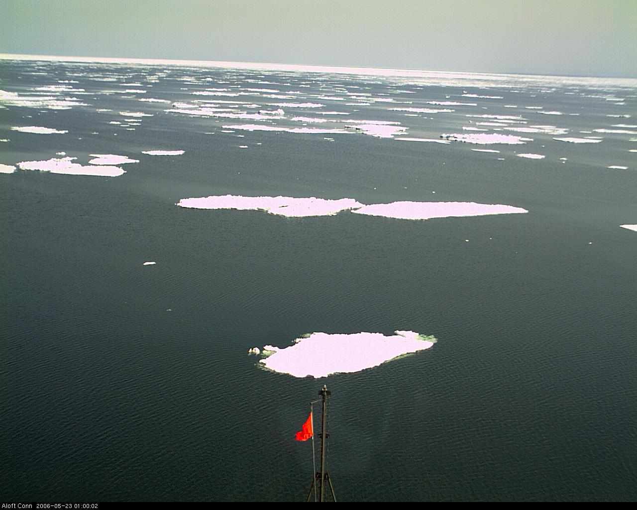
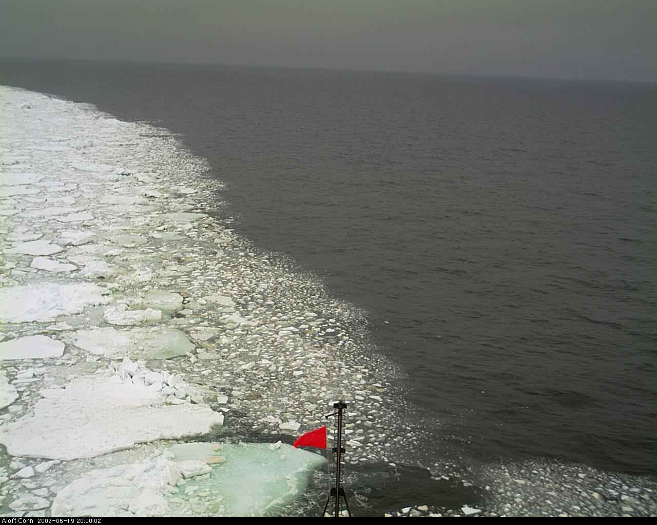
Here's a view of sea ice off the starboard bow taken by the Healy webcam. Well, I don’t want to give away all of the details yet. Stay tuned ….

Countdown: five days

In five days I'll head from Newark, NJ to Nome, AK. It’s 33 degrees F there this morning. Brrrrr…. Nome dots the coastline of Alaska’s Seward Peninsula, just south of the Bering Strait. The town is a major shipping hub for the region, but Nome is best known as the finish line for the 1,049-mile-long dogsled race called the Iditarod, which takes place at the end of March each year. This wasn’t always the case. Around 1900, the name "Nome" was synonymous with "gold."

More than 12,000 gold rushers poured into Nome off of steamships at the turn of the 20th century after word spread that "three lucky Swedes" found gold in nearby Anvil Creek. A few gold mines still operate in Nome today, but now tourism has replaced gold as the lure that brings visitors to the town. In fact, about 20,000 flock to Nome each summer to view wildlife and birds, fish, hunt, hike, learn about Alaskan native culture and more.

Check out the online Nome photo gallery. Of course, you won’t want to miss photos of Velvet Eyes, Nome’s goodwill ambassador reindeer.

Monday, May 15, 2006

Countdown: one week

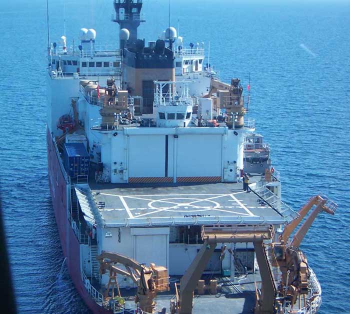
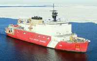
I'm getting ready to head to the Bering Sea, the icy waters between Alaska and Russia. My destination: a 420-foot-long Coast Guard icebreaker called the Healy. Starting in early May, this ship sailed north from Dutch Harbor, Alaska. The Healy will sail back and forth across a planned route so scientists can study the marine animals in the Bering Sea waters.

In recent years, the researchers have discovered that the water and air temperatures are rising. Warmer temperatures affect the balance of the marine ecosystem.
In the Bering Sea, bearded seals, walruses and diving birds feed on bottom-dwelling critters. Scientists think warmer waters may encourage fish to swim farther north to compete for food with the seals, birds and walruses. Using water tubes, nets and their own eyes, the scientists are gathering samples and details to find out if their hunch is correct. Stay tuned...